Welcome to the Trails of Wilmington, Vermont!
Join us for a hike on the Hoot Toot and Whistle Trail Saturday June 6 at 10 am!
Meet at the new trailhead parking area – use 163 Fairview Avenue as the address. . The trail map is here.
Click here for more information about the Hoot, Toot, and Whistle Trail.
![]()
Read the Wilmington Trails Committee’s 2025 annual report.
In 2024 Vermont Outdoor Recreation Economic Collaborative (VOREC) Community Grant Program awarded Wilmington $227, 700 to upgrade and improve the accessibility of the Hoot, Toot, and Whistle Trail (#2 on the map below). Click here for more information about the Hoot, Toot, and Whistle Trail.
![]() Donate
Donate
Maps | Trails | Pedestrian Counts | Hikes | Trail Committee | Friends of the Trails
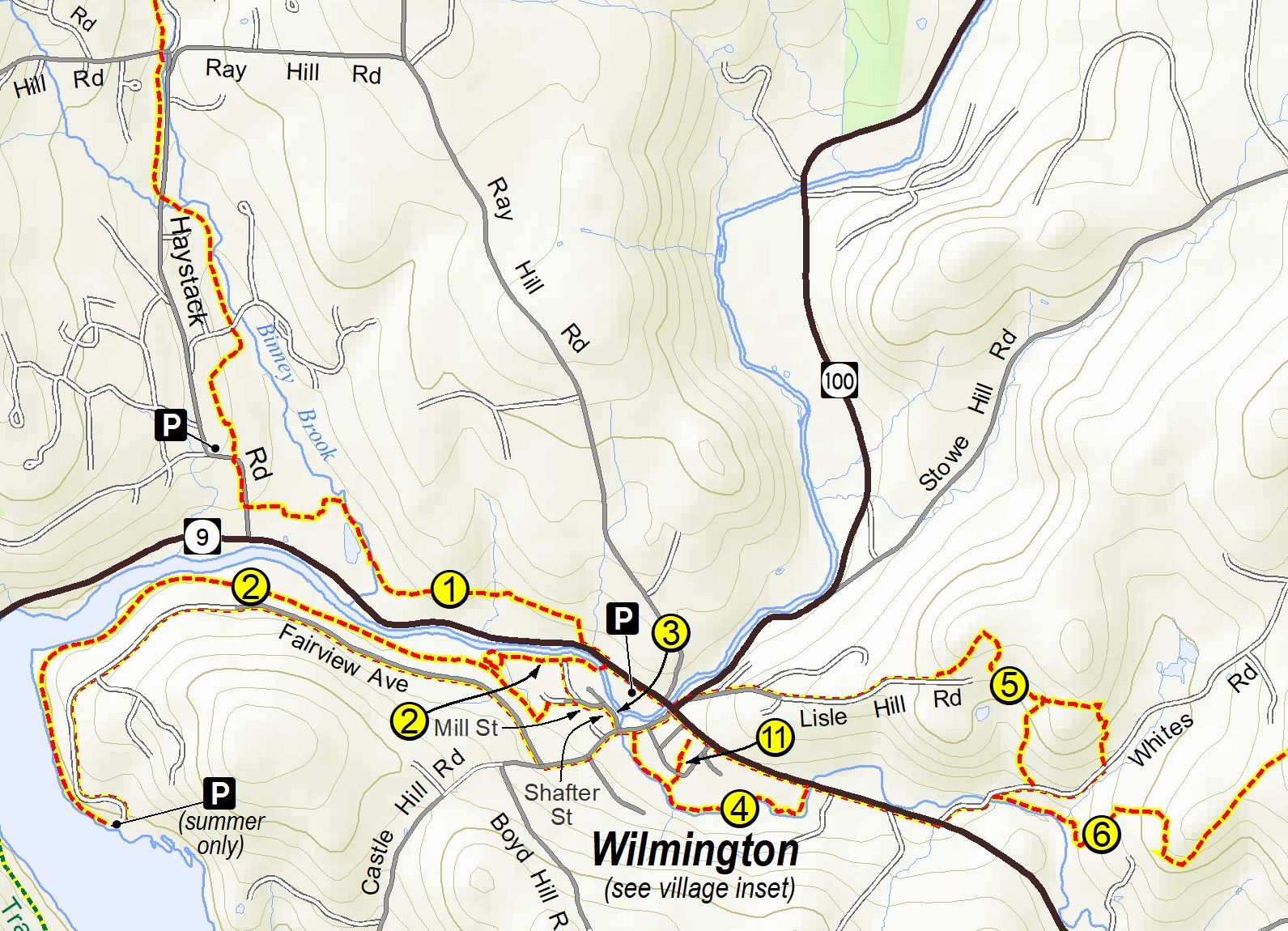
Click to zoom in on this area. See below for more maps.
Trail maps for a computer, tablet, phone, or printing
- High-resolution map for a computer
- Medium-resolution map for a tablet or phone
- High-resolution PDF map for printing
- Trail descriptions on back of map
- Dog-friendly trail map by Wilmington Wags
- Other trails in the region
Trail maps and apps that show your location on your phone
- GPS-enabled GeoPDF map for Avenza Maps on Android or iOS
- GPS-enabled KMZ map for Custom Maps (Android), Map Plus (iOS), or Google Earth
- GPS-enabled KML map for Google Earth on iOS
To use these GPS-enabled maps and apps:
-
- Download the GPS-enabled map file to your phone.
- Install the matching app from the app store.
- Open the app and direct it to the saved map file.
- Hike a trail and see where you are on the map!
Trail Descriptions
- Valley Trail
- Hoot, Toot & Whistle Trail. New construction info is here.
- Downtown Loop
- Beaver Brook Trail
- Lisle Hill to White’s Road
- Primitive Trail to Lake Raponda
- Lake Raponda Trail
- Ware Homestead & Hogback Connector
- Raponda Ridge Trail
- Shearer Hill Trail to Mt. Olga
- Monument Trail
Loops and Hikes
Follow Wilmington’s trails and roads for enjoyable hikes.
- Raponda Ridge loop
- Old Stage Road loop
- Ware Road loop
- Town Forest loop and Tree Walk
- Hogback loop
- Sun and Ski loop
- Hoot Toot & Whistle loop
- Historic Downtown Wilmington loop
Wilmington Trail Committee
This resolution of the Wilmington Selectboard defines the committee.
This document describes the roles of committee members
These volunteers build and maintain Wilmington’s trail system.
Would you like to help plan and maintain Wilmington’s trails? Join the Trail Committee! Contact us at [email protected].
The committee’s working documents are here. The Hoot Toot and Whistle Trail upgrade documents are at https://bit.ly/hoottoot
If you see a problem on a trail, contact us at [email protected]. Send a photo if you can. The trail maintenance to-do list is here.
Friends of the Wilmington Trails
Friends of the Wilmington Trails help with occasional work bees, publicity, and other supportive tasks. To learn more or to join our mailing list, send an email to [email protected].
For print media and images, the shortcut to this page is http://wilmingtontrails.org. The QR code is
